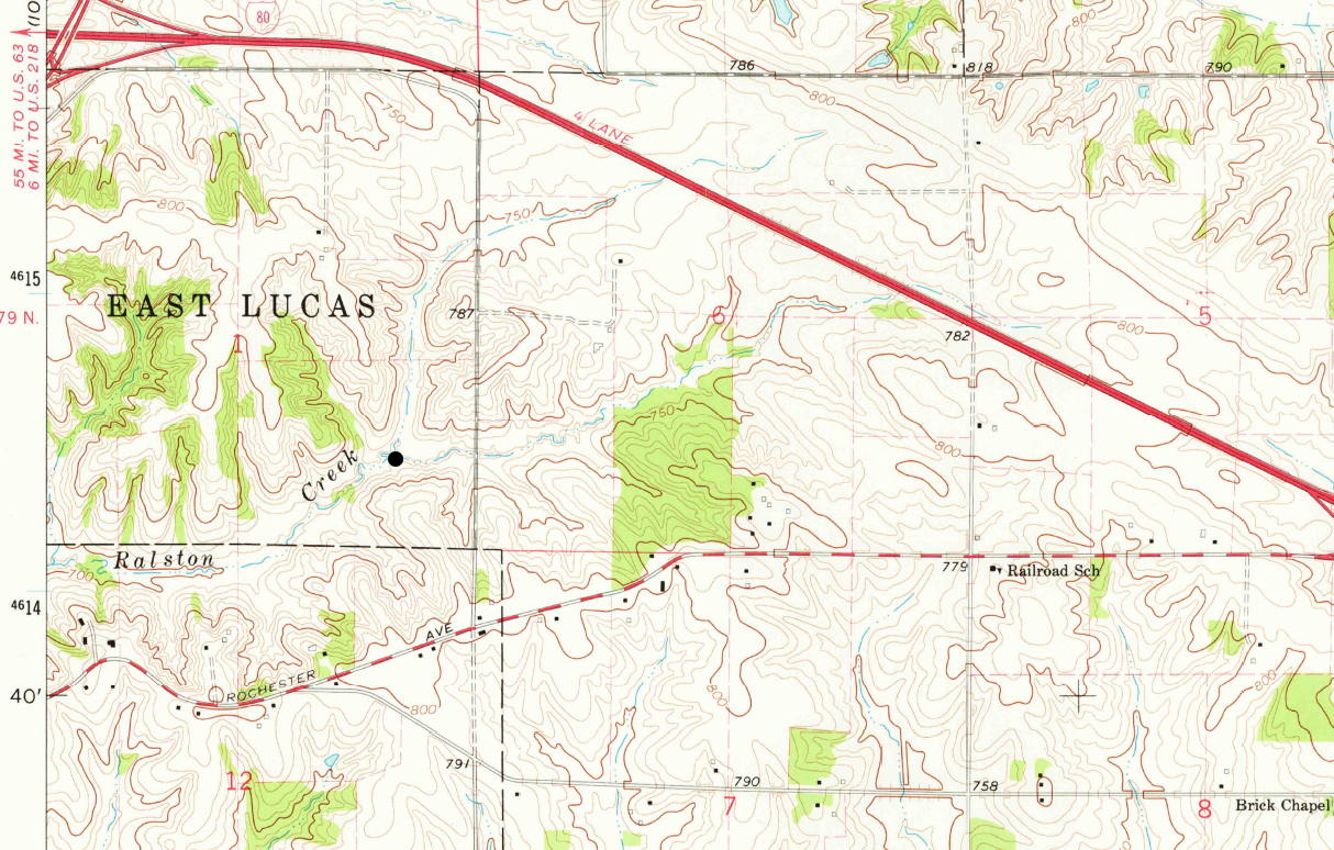
The topography east of Iowa City 1965 is shown in the USGS 7.5 minute Topo Map (Iowa City East Quadrangle). Use this map to delineate the drainage divide (or watershed) of a headwater tributary to the North Branch Ralston Creek. The outlet of the watershed is indicated by the black circle.