
|
[Home]
|
[Lessons]
|
[Handouts]
|
Evaporation Measurement
Pan Evaporation
Perhaps the simplest way of measuring evaporation is with an evaporation pan. Historical records of daily pan evaporation are available from the National Climatic Data Center (NCDC) for U.S. Weather Buruau Class A Land pans. The Class A plan has the following characteristics: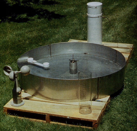
- 4 foot diameter
- 10 inches deep
- well-ventilated (bottom raised 6 inches off ground)
- filled to an 8 inch depth
Evaporation from an open water surface (E) is usually estimated from the pan evaporation (Ep) as:
E = K Ep
where K is the pan coefficient. Similar expressions are also used in practice to estimate potential evapotranspiration from pan data.
Evaporation Measurement (Other Approaches)
Several other approaches for measuring evaporation are:- Weighing Lysimeter
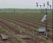
A lysimeter is an instrument for measuring the water that percolates through a certain depth of soil. The device is installed in the field and holds soil and vegetation. Weighing of its contents is used to measure changes in water storage. - Sonic Anemometer
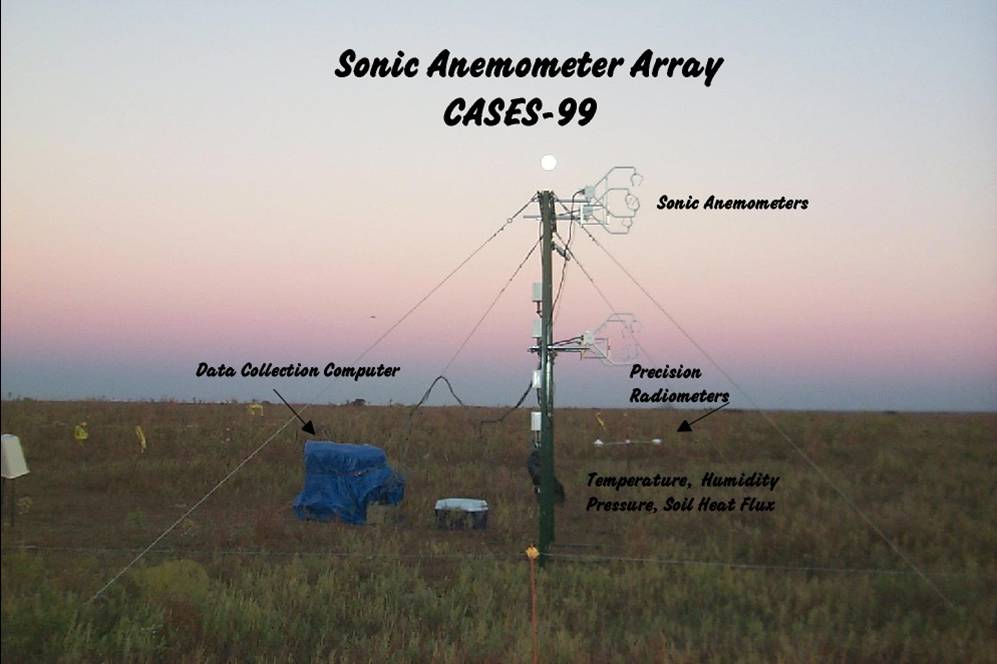
A sonic anemometer is measure fluctuations in vertical wind velocities near the earth's surface. When combined with coincident measurements of humidity, evaporation can be computed using an eddy-correlation technique. - Lidar
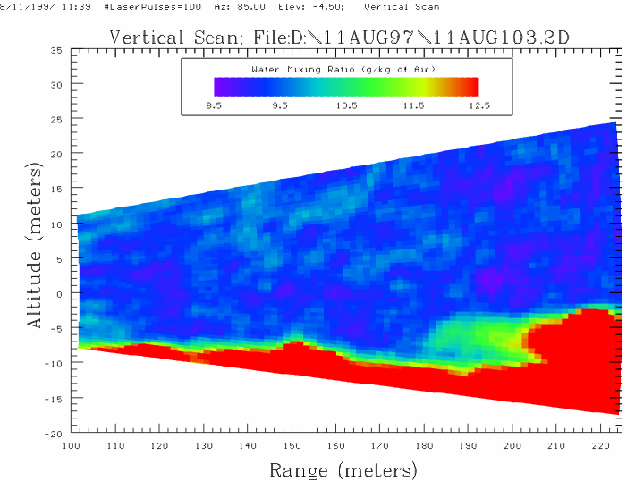
A lidar emits laser light and measures the reflection off objects in the beams paths. Certain lidars are able to measure water vapor in the atmosphere. Using theory on the variations of water vapor with height, evaporation rates can be computed.
Last changed on 01/07/14 by Gabriele Villarini.